From Center City to Bartram’s Garden: The Schuylkill Crossing Is Almost Here
Click the map to enlarge.
I’ve been looking forward to this one for a long time. Soon, we should be able to walk, run, or bike from Center City all the way to Bartram’s Garden on a connected, off-road trail along the Schuylkill. How cool is that?
The missing piece is the Schuylkill Crossing, a new swing bridge connecting Grays Ferry Crescent to Bartram’s Mile. Schuylkill Banks has announced a ribbon cutting for November 13, with the bridge expected to open that afternoon. I can’t wait to try the full route once it opens.
How the route comes together
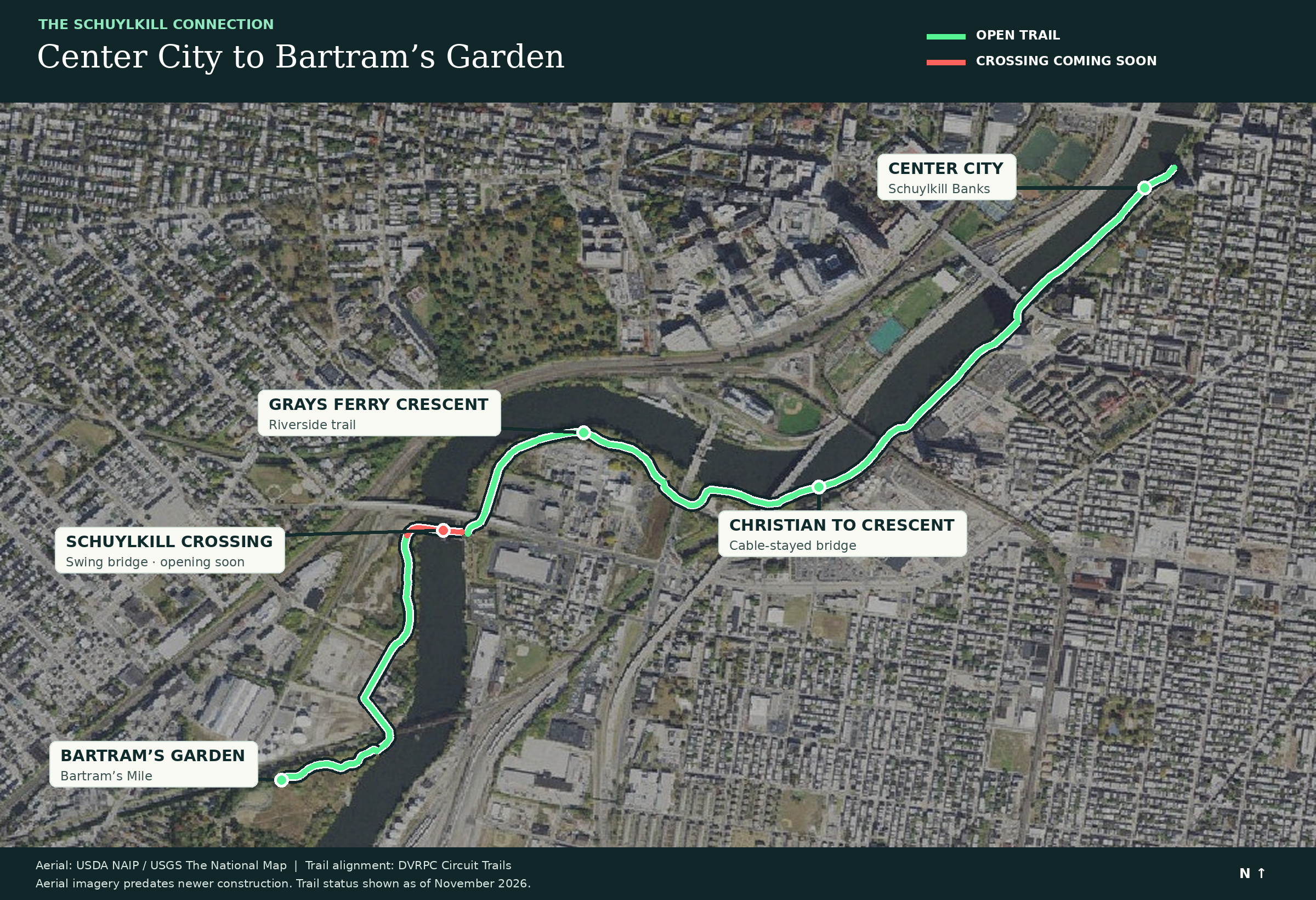
Start on Schuylkill Banks in Center City and head south. The Christian to Crescent connector, which opened in 2025, carries the trail along the east bank, including a 650-foot cable-supported bridge and a tunnel beneath the 34th Street Bridge. From there, you continue through Grays Ferry Crescent.
The new Schuylkill Crossing will take you across the river to the west bank and Bartram’s Mile, the riverside trail that leads through Bartram’s Garden. Put those pieces together and you have a continuous off-road trip from Center City to one of the city’s most special green spaces.
The route: Schuylkill Banks → Christian to Crescent → Grays Ferry Crescent → Schuylkill Crossing → Bartram’s Mile → Bartram’s Garden.
See the full route map, or click the image above to enlarge it. Green shows the open trail, and red shows the crossing that is still to come.
A bridge that swings for boats
Here’s the detail that really appeals to the sailor in me. The crossing sits just south of the Grays Ferry Avenue Bridge, where a railroad bridge once crossed the Schuylkill. The old railroad truss was removed, but the project builds on that history: a new swing truss sits on the rehabilitated historic center pier, with rehabilitated approach spans.
When a tall vessel needs to pass, the bridge can pivot open. One moment it’s part of a trail; the next it’s making room for a boat on the river. I think that is pretty sweet.
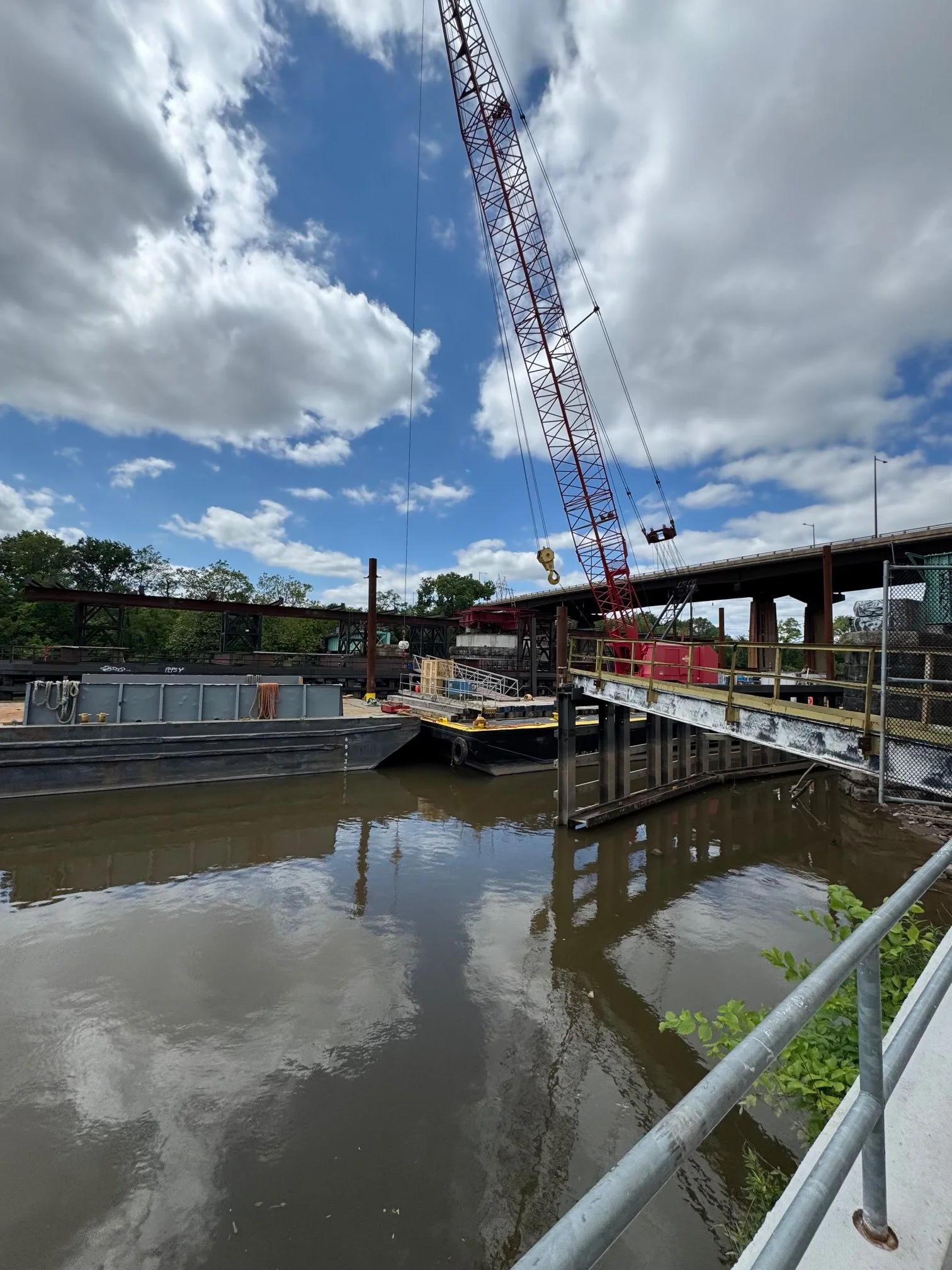
Schuylkill Crossing swing bridge under construction. Photo by James Price.
Why make the trip to Bartram’s Garden?
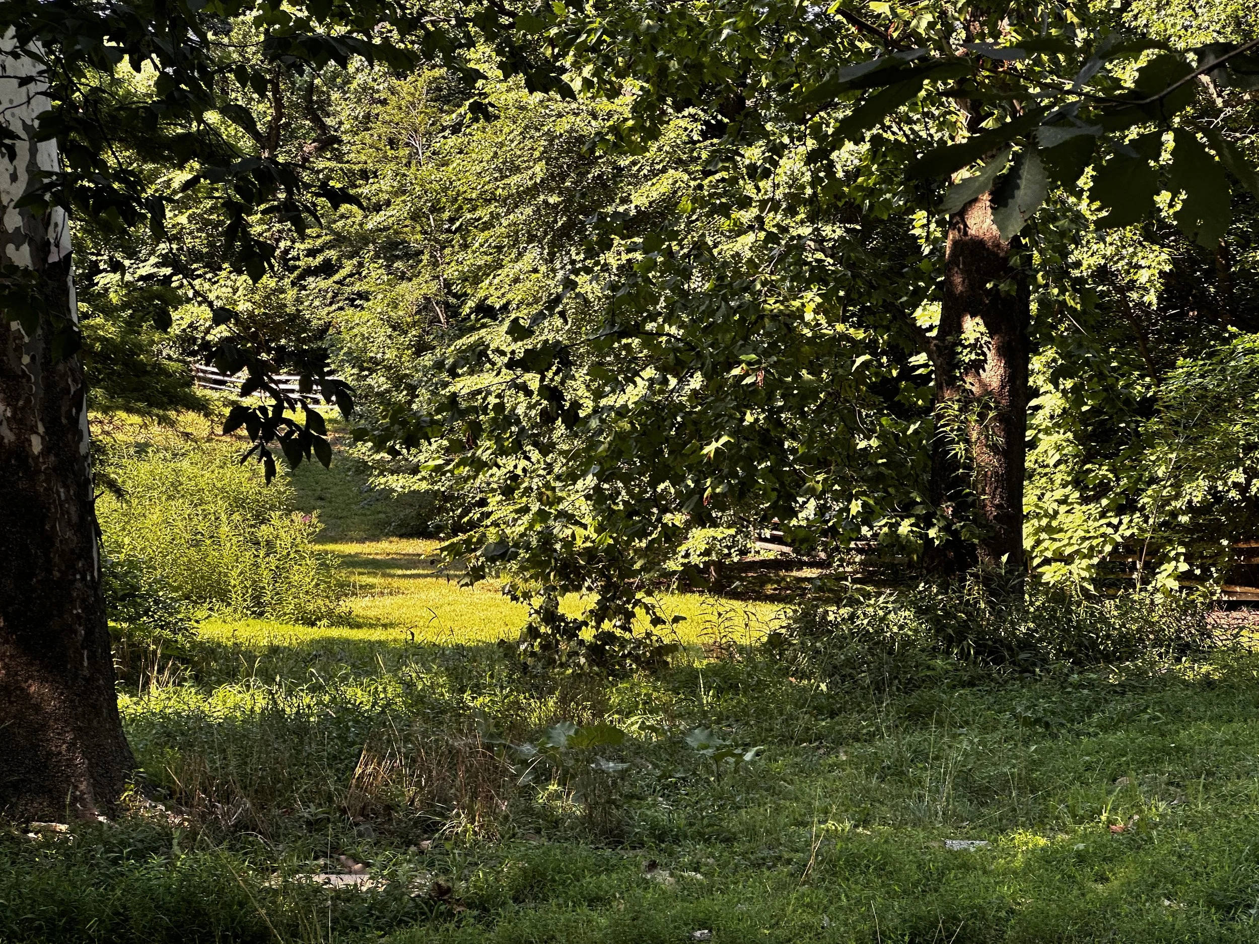
If you haven’t been, give yourself time to explore. Bartram’s Garden is a nearly 50-acre public garden and riverside landscape in Southwest Philadelphia, with historic buildings, gardens, natural areas, and views back toward the city. It’s also home to Sankofa Community Farm and a community boathouse.
Bring a picnic, wander the grounds, watch the river, or check the Garden’s calendar for programs and seasonal boating opportunities. The grounds are free and open to pedestrians daily from sunrise to sunset. It’s the kind of place that makes you feel like you’ve discovered a whole different side of Philadelphia.
And keep an eye out for FloatLab, a bright yellow floating ring that brings art and ecology together on the Schuylkill. Once it opens, you’ll be able to walk down inside it and see the river at water level while staying dry. How cool is that? Bartram’s Garden now expects it to open to the public in spring 2027, so check its website before planning a visit.
When can we go?
Friday, November 13, 2026, from 2 to 4 p.m. is the ribbon-cutting celebration at Grays Ferry Crescent Esplanade, near Wharton Street and Schuylkill Avenue. Remarks begin at 2, and the ribbon cutting and bridge opening are planned for 3 p.m.
There will be fall treats and free opening-day sweatshirts while supplies last. Street parking is limited, so consider walking, biking, or taking SEPTA. Check the official event page for the latest details before you go.
For more on the route and the destination, see Christian to Crescent and Bartram’s Mile.
I love seeing Philadelphia reconnect with its river, and this is one I’ve been waiting for. Once it opens, I’m looking forward to getting out there and seeing the whole route for myself. Maybe I’ll see you on the trail!
James
Map: Aerial imagery from USDA NAIP and USGS The National Map; trail alignment from DVRPC Circuit Trails. The aerial predates newer construction. Trail status as of November 2026.
Garden photo: Muran.Fox via Wikimedia Commons, CC BY-SA 4.0. Image unchanged.
Tree photo: Magpieturtle via Wikimedia Commons, CC BY 4.0. Image unchanged.